
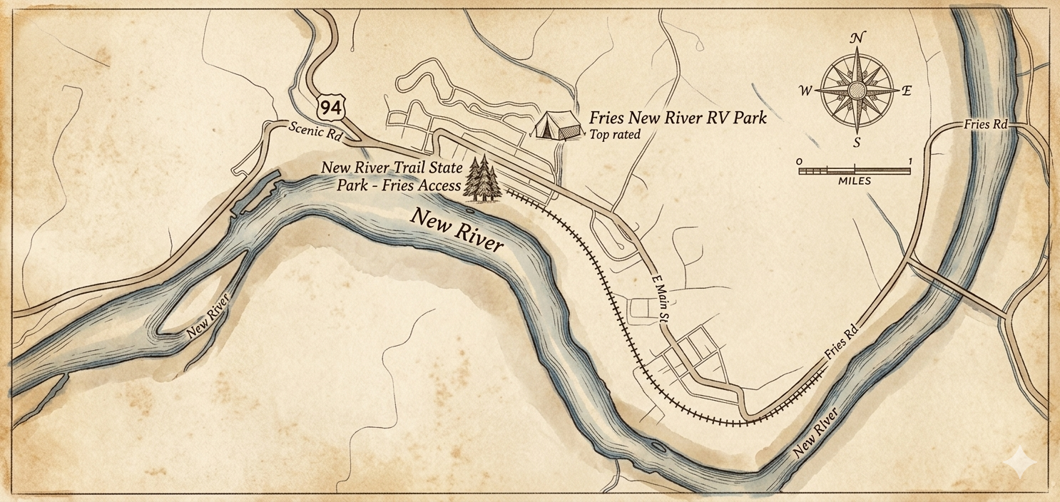
Maps and access points
Access points, parking, and mileage along the New River Trail
The New River Trail has six primary access points along its 57-mile length. The details below cover parking, facilities, mileage, and location for each.
All access points have parking, though lot sizes vary. Most have restrooms and picnic areas. Foster Falls is the main visitor center and has the most facilities.
Trailhead information
Detailed information for each access point along the trail
Location
Fries, VA 24330
36.7161° N, 80.9785° W
Parking
Large lot, 40+ spaces
From Fries
0 miles (starting point)
Facilities
Restrooms, picnic area, water fountain
Accessibility
Wheelchair accessible
Surface
Crushed limestone
Location
Cliffview, VA
36.702° N, 80.916° W
Parking
Small lot, 15 spaces
From Fries
5 miles north on trail
Facilities
Parking only
Accessibility
Limited accessibility
Surface
Crushed limestone
Location
Austinville, VA
36.7846° N, 80.9348° W
Parking
Medium lot, 25 spaces
From Fries
7 miles north on trail
Facilities
Restrooms, picnic area
Accessibility
Partially accessible
Surface
Crushed limestone
Location
Foster Falls, VA 24360
36.9167° N, 80.8500° W
Parking
Large lot, 50+ spaces
From Fries
28.6 miles north on trail, 45 minutes by car
Facilities
Visitor center, restrooms, picnic area, water
Accessibility
Fully accessible
Surface
Crushed limestone
Location
Austinville, VA
80.835° N, 80.835° W
Parking
Medium lot, 30 spaces
From Fries
38.4 miles north on trail, 55 minutes by car
Facilities
Historic site, restrooms, picnic area
Accessibility
Partially accessible
Surface
Crushed limestone
Location
Galax, VA 24333
36.668150° N, 80.924720° W
Parking
Large lot, 45 spaces
From Fries
15 miles south, 20 minutes by car
Facilities
Restrooms, picnic area, water fountain
Accessibility
Wheelchair accessible
Surface
Crushed limestone
Planning your route
Getting to the trail from Fries
Fries, Virginia serves as an excellent base for accessing the New River Trail. The Fries Trailhead is located in the heart of town with clear signage and ample parking. From downtown Fries, simply follow Main Street to the trailhead parking area.
For other access points, take US-94 north from Fries to reach Cliffview and Byllesby Dam. Foster Falls and Shot Tower are accessible via I-77 and require approximately 45-55 minutes of driving from Fries. Galax is located 15 miles south of Fries via US-94 and VA-89.
Trail navigation tips
The New River Trail is well-marked with mile markers every half-mile, making it easy to track your progress and plan rest stops. Trail maps are available at major access points, and we recommend downloading offline maps before your trip as cell service can be unreliable in some areas.
For one-way trips, consider arranging a vehicle shuttle or using local shuttle services. Many visitors park at one trailhead, bike or hike to another access point, and arrange pickup. This allows you to experience different sections of the trail without backtracking.
Accessibility information
The New River Trail's gentle grade and smooth crushed limestone surface make it one of the most accessible long-distance trails in Virginia. The Fries and Foster Falls trailheads offer the best accessibility features, including wheelchair-accessible restrooms, parking, and trail access.
While the trail surface is generally suitable for wheelchairs and adaptive bikes, some sections may be challenging after heavy rain. The historic trestles have wooden plank surfaces with small gaps that may require caution. Contact the visitor center at Foster Falls for current accessibility conditions.
More Trail Information
The trail guide covers surface, route, and activities. The trip-planning page has itineraries and a checklist.